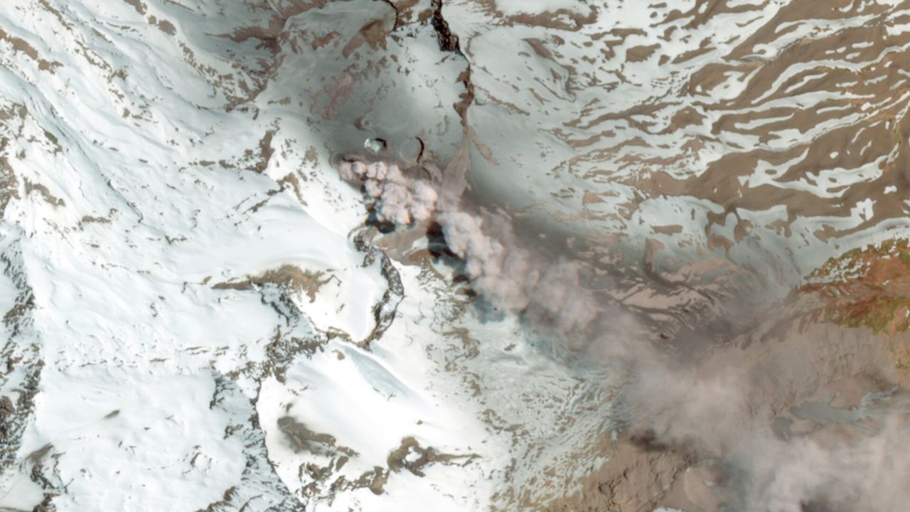
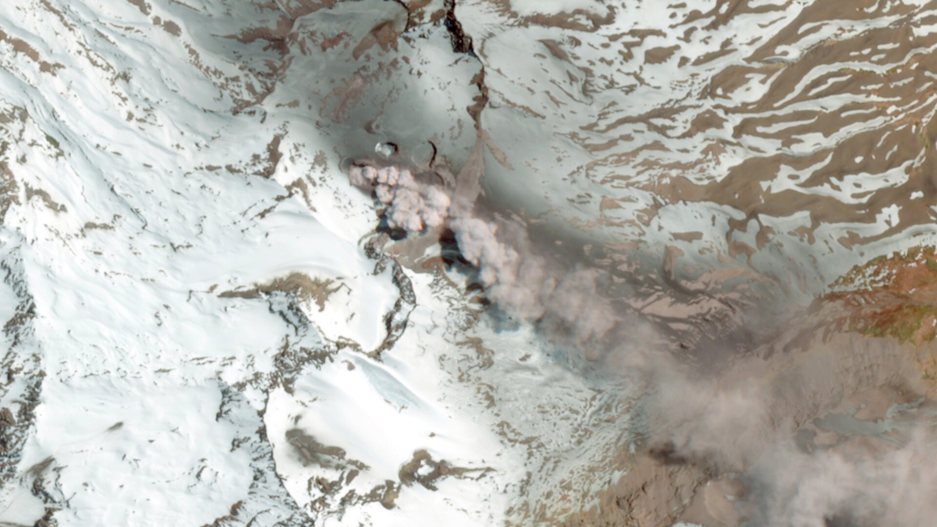
On Oct. 25, 2025, Europe’s Sentinel‑2 satellite mission captured a striking image of the Planchón-Peteroa volcanic complex, located on the border between Chile and Argentina, emitting a plume of ash and volcanic gas rising roughly 1,970 feet (600 meters) above the crater. The ash plume drifted north‐northwest initially and then, under changing wind conditions, veered eastward across the Argentine side.
What is it?
There are currently three Sentinel-2 satellites in orbit — Sentinel-2A, Sentinel-2B and Sentinel-2C, which launched in 2015, 2017 and 2024, respectively. They’re part of the European Union’s Copernicus Earth-observation program, whose first satellite (Sentinel-1A) launched in 2014.
Where is it?
The Planchón-Peteroa complex sits in the Andes mountain range, at a high altitude in a region dominated by snow‐covered peaks and volcanic terrain.
Why is it amazing?
Because the Planchón-Peteroa volcanic complex is remote, rugged and spans two countries, satellite imagery plays a vital role in monitoring volcanic activity, ash dispersal and potential impacts on air pollution, local communities and the environment. The snow-covered ground enhances the visibility of the ash plume as it drifts across the landscape, allowing for better tracking by the ESA satellite.
With the ash crossing from Chile into Argentina, the image shows how volcanic events do not respect national boundaries — and international monitoring systems like Copernicus are key.
Want to learn more?
You can learn more about the European Space Agency and the Copernicus program.