The Artemis 2 astronauts are on their way to the moon, and you can track them every step of the way.
NASA’s Artemis 2 mission launched April 1 from Kennedy Space Center in Florida, sending four astronauts on a 10-day trip around the moon in an Orion capsule. It’s the first crewed mission to venture beyond low Earth orbit (LEO) since Apollo 17 in 1972.
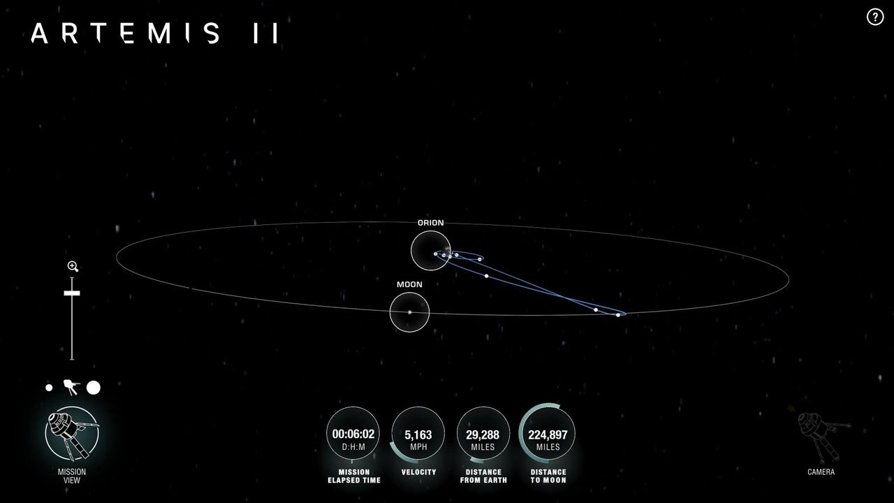
“Using AROW, anyone with internet access can track where Orion and the crew are, including their distance from Earth, distance from the moon, mission duration and more,” NASA officials said in a statement.
AROW will allow the public to “visualize data that is collected by sensors on Orion and then sent to the Mission Control Center at NASA’s Johnson Space Center in Houston during its flight,” agency officials added. “It will provide constant information using this real-time data beginning about one minute after liftoff through Orion’s atmospheric reentry to Earth at the end of the mission.”
AROW will also provide background information about the moon and Apollo landing sites, according to the NASA statement. You can access it via NASA’s website or by using the NASA app.
The app has a bonus feature: an augmented-reality tracker, which “will direct users where to move their phone to see where Orion currently is relative to their position on Earth.”

The four Artemis 2 astronauts are NASA’s Reid Wiseman, Victor Glover and Christina Koch, and Jeremy Hansen of the Canadian Space Agency. Glover will be the first African-American to leave LEO; Koch and Hansen will be the first woman and the first non-American to do so, respectively.
Artemis 2 is a test flight designed to validate Orion’s ability to support crewmembers in deep space. It’s a key step in NASA’s Artemis program, which aims to establish a long-term human presence on and around the moon in the coming years.